Separation Barrier Assignment
Due: Tuesday, April 29th in class
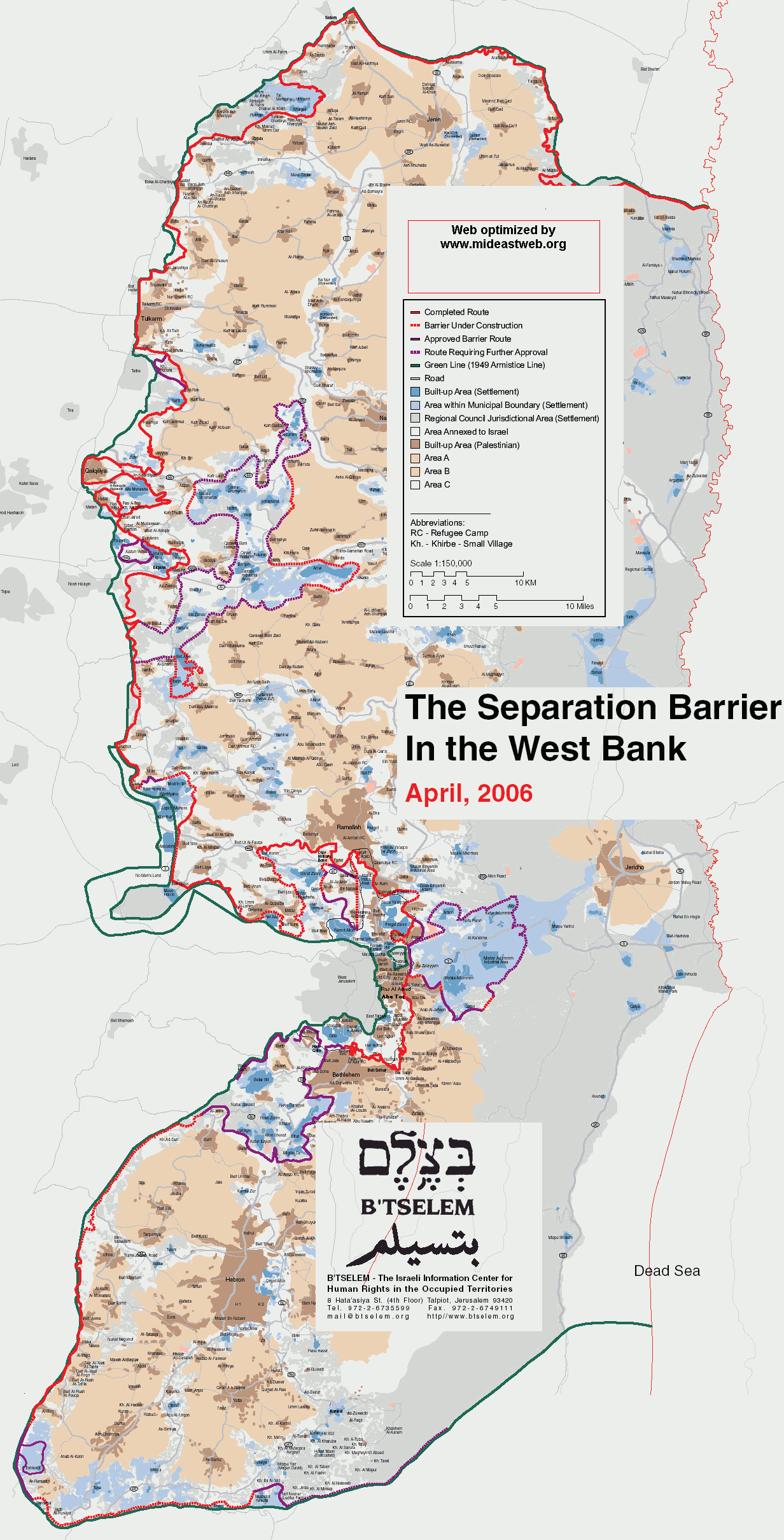
This assignment is designed to introduce the student to the physical barriers in place in and around the
Look at the following map and answer the questions below:
http://www.mideastweb.org/betselem_fence_06.gif
- Locate Jenin,
- Trace the route of the Separation Barrier in and around the
- Estimate the number of established Israeli settlements within the
Watch the following short film and answer the questions below:
http://www.btselem.org/english/video/200803_Road_443.asp
- To where does route 443 go?
- Why did the Israeli military close route 443 to Palestinians?
- How do the Israelis pictured in the film feel about route 443?
- How is travel different for Palestinians and Israelis within the
- Why are there walls built along route 443? What purpose do they serve?
- From whose perspective is this film made? Whose is left out? How do you or do you not feel this film is biased?
Watch the following short film and answer the questions below:
- Where is the Security Fence?
- According to this film, what purpose does the security fence serve?
- From whose perspective is this film made? Whose is left out? How do you or do you not feel this film is biased?
Please feel free to write any additonal thoughts, reflections, or questions you have based on viewing these images.
No comments:
Post a Comment